
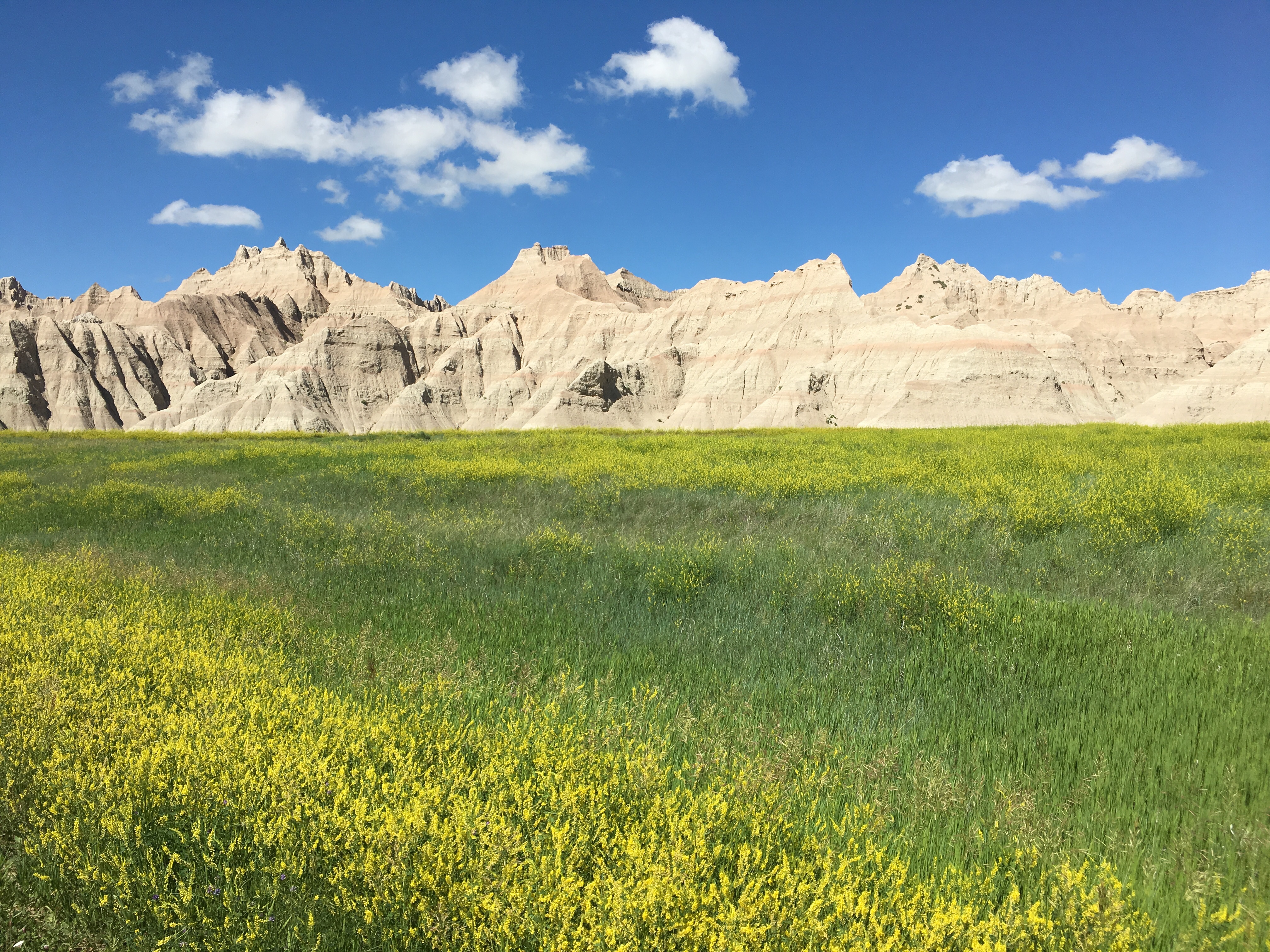
If you’ve ever wanted to see the Badlands, go now … they are crumbling. It’s a world of sandcastles on the Crayola plains. Stunning vistas but when you get up close, you experience the effects of extreme weather washing them away.
Last night’s lightening infested skies brought torrential rain and thundering wind that shook Betty like a space shuttle re-entering earth’s atmosphere. How the tenters survived we can’t say, but the morning sun shone dry and the campground emptied for the day’s activities. Our Badlands bike and hike would have to wait, as our booked site #4 was unexpectedly petite and Betty is extra long.
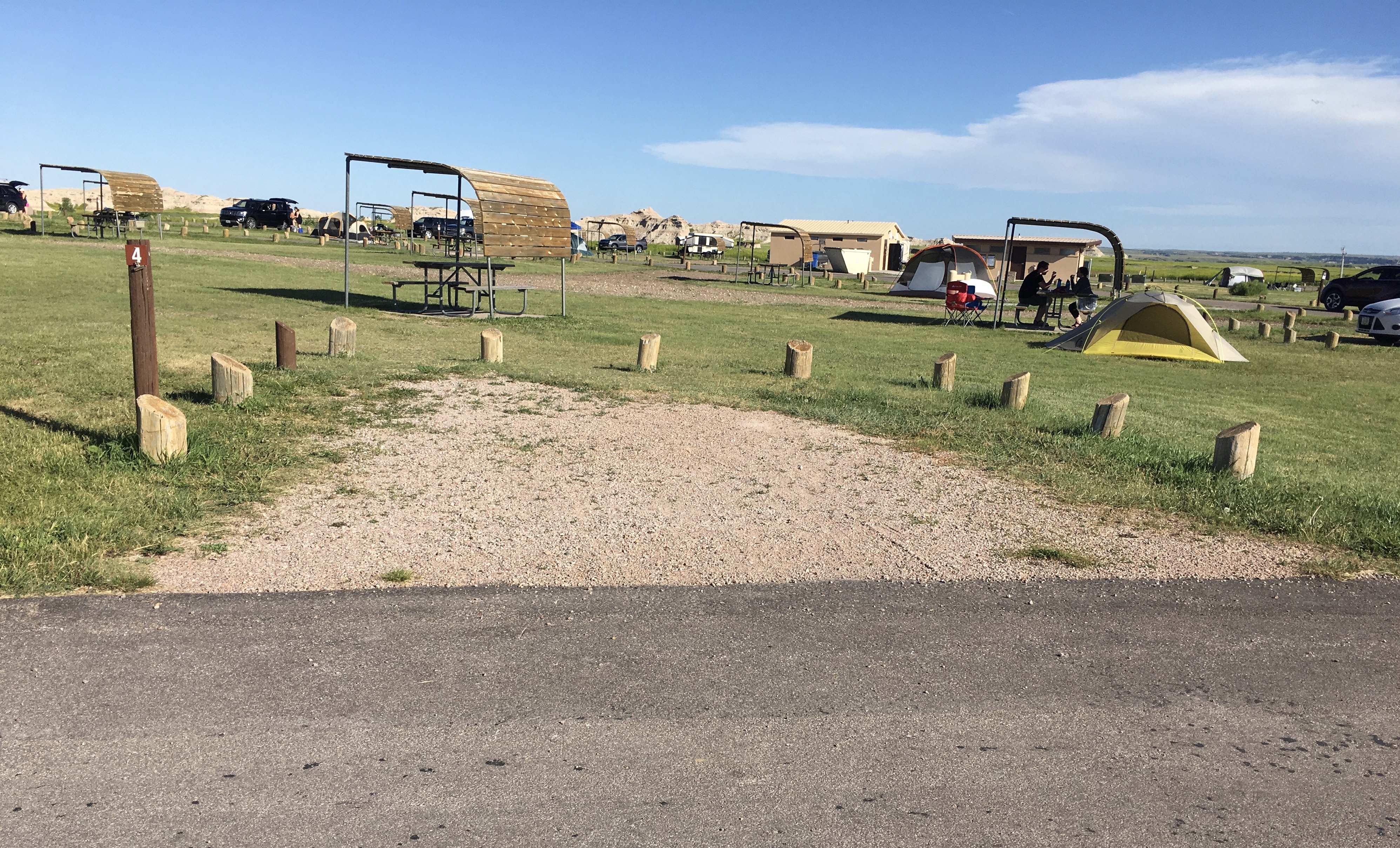
Since we couldn’t get tandem night sites, Eric booked the two RV-available, knowing we’d have to move. Fortunately he scoped out the new site prior to the move and discovered we’d never fit. After some negotiating with the camp host, the cabin attendant and the cashier at the general store, they agreed we could go to site 1 if we were less than 30 feet. “Yup,” Eric said. “No problem.” Sometimes you gotta say what you gotta say to get your favorable way. With some major parking skill, the aircraft carrier landing experience kicked in and 34’10” Betty was in 30′ site #1 by a nose.
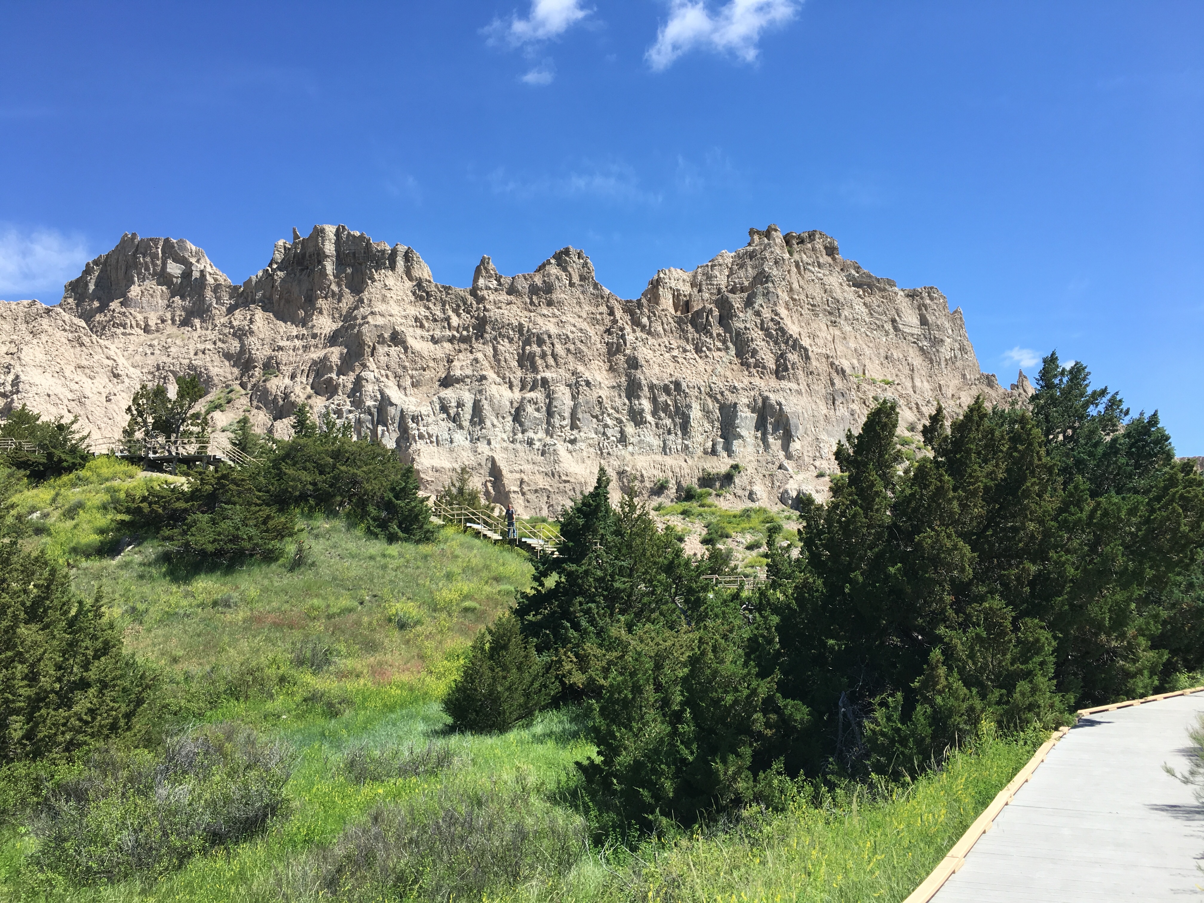
We got our feet wet on the Cliff Shelf Nature Trail, climbing stairs through the forest along the Badlands Wall. We could see the fragile nature and wanting to get more up close and personal, we biked on to Cedar Pass for a different kind of climb.
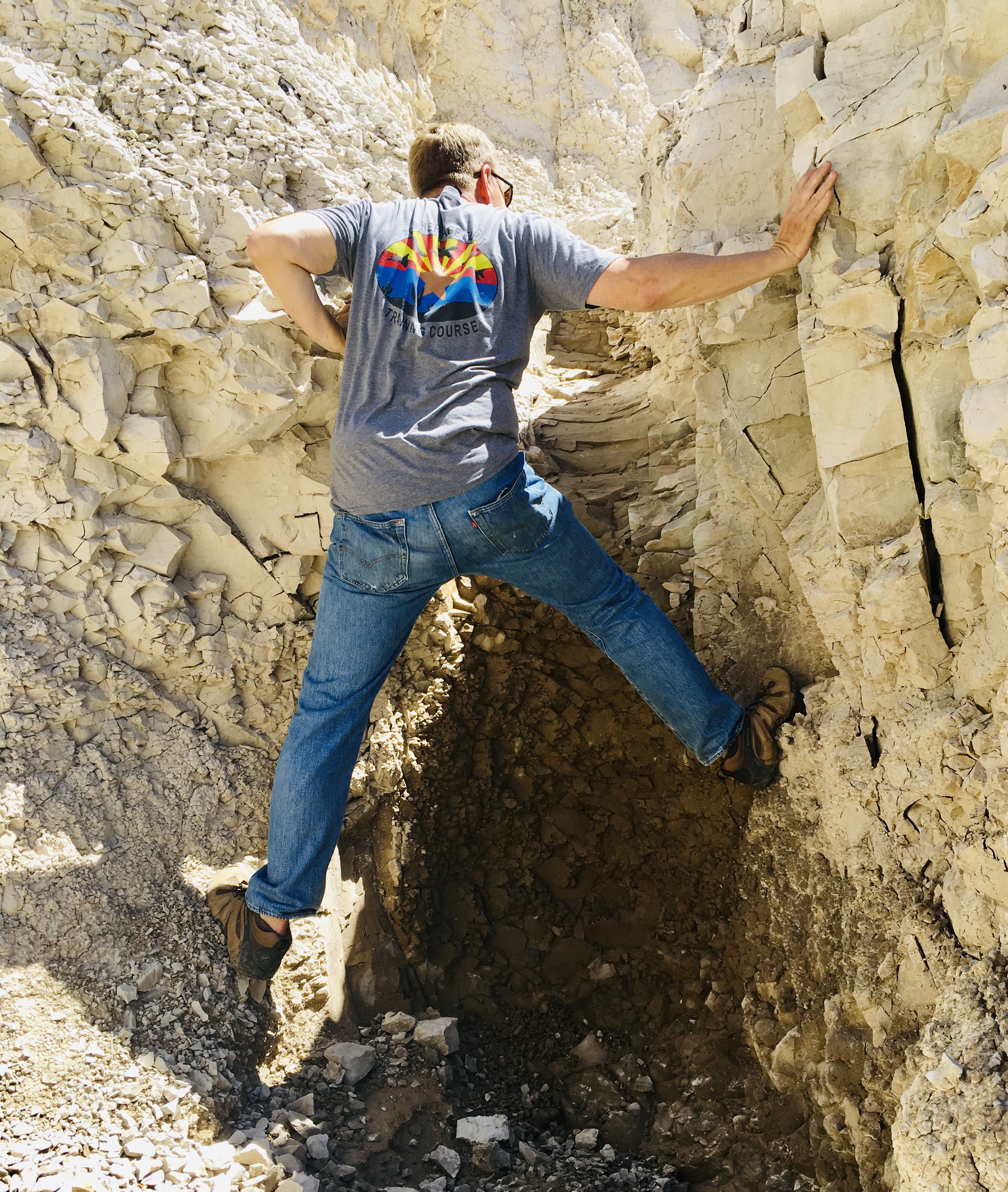
This is the one where Eric tries to scale the formation but every foot and hand placement crumbles like dry clay to the ground. Moving on …
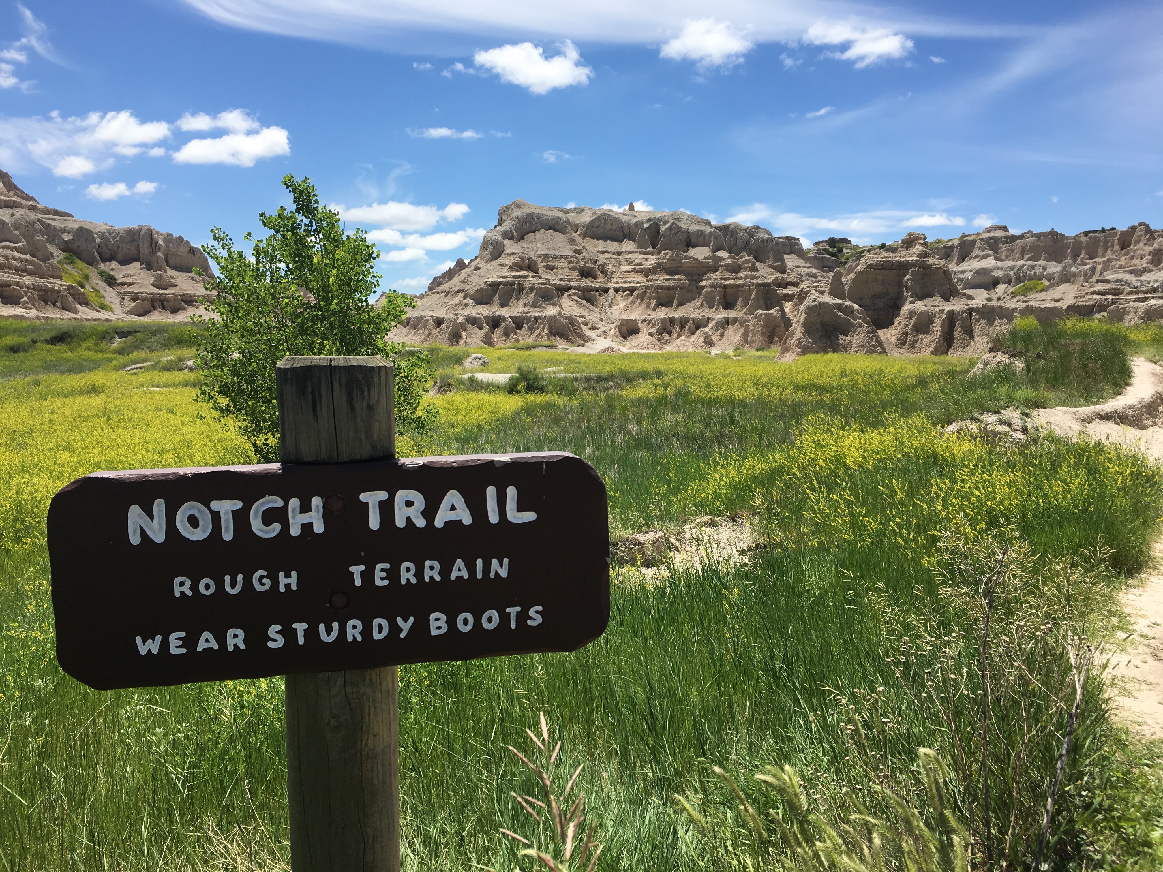
The Notch Trail is billed as “meander through a canyon, climb a log ladder and follow the ledge to “the Notch” for a dramatic view of the White River Valley.” With Eric’s fear of heights (and clowns) and Sheri’s fear of falling, we were a good match for this excursion.
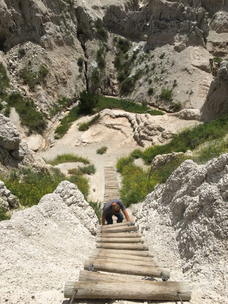
The meandering was easy, the log ladder was steep and the dramatic view of the White River Valley was the exact same view as the Cliff Shelf Nature Trail we had done an hour earlier! But we did get to see a quartet of amateur paleontologists learning how to use a pick axe in the excavation process. And check our email at the highest point on a trail in the park.
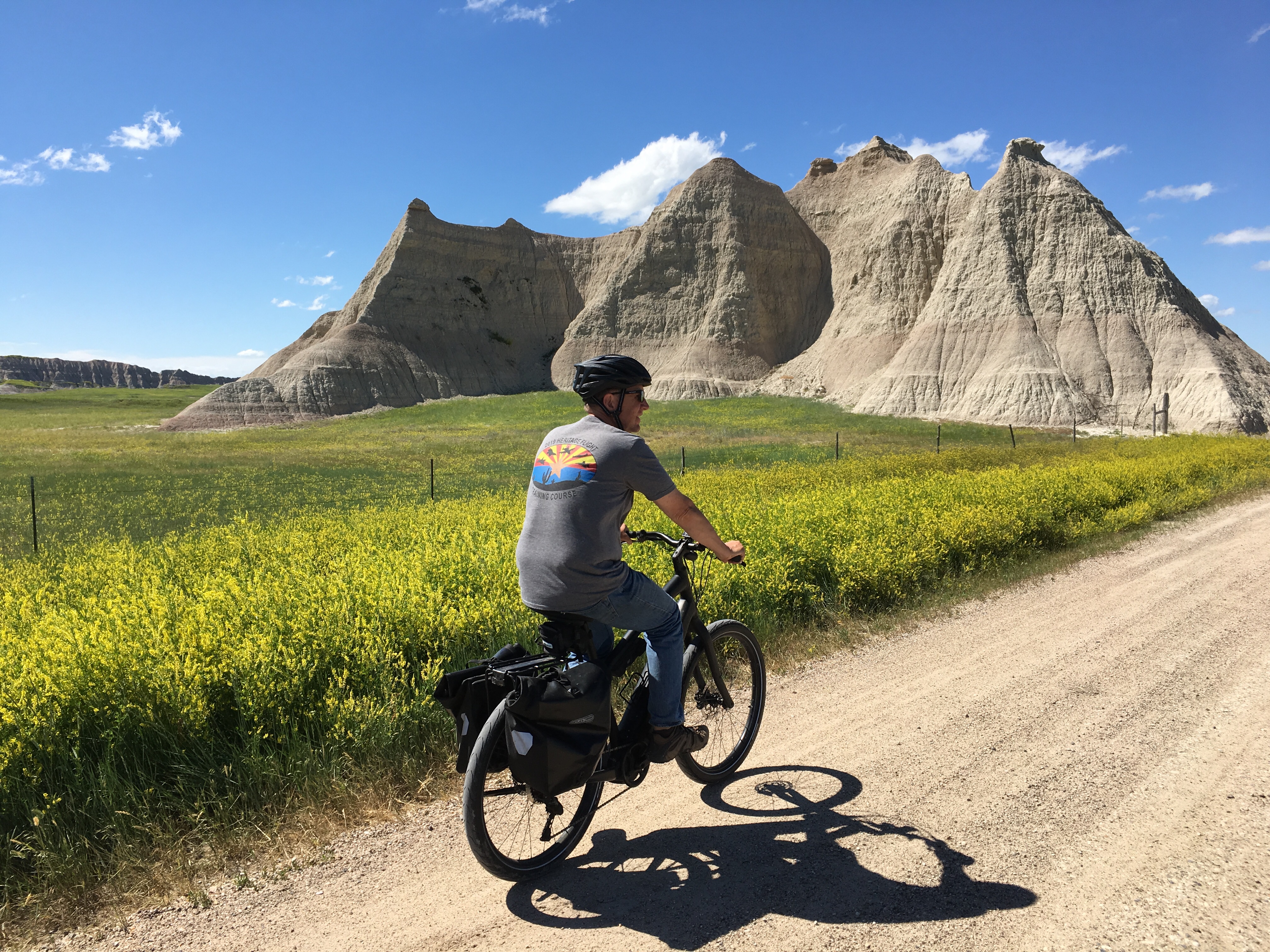
Deciding we’d had enough of the published trails, Eric consulted google maps for Badlands surrounding roads and mapped a 10 mile dirt road exploration route that took us into the nearby town of Interior, just 2 miles outside the entrance to the park.
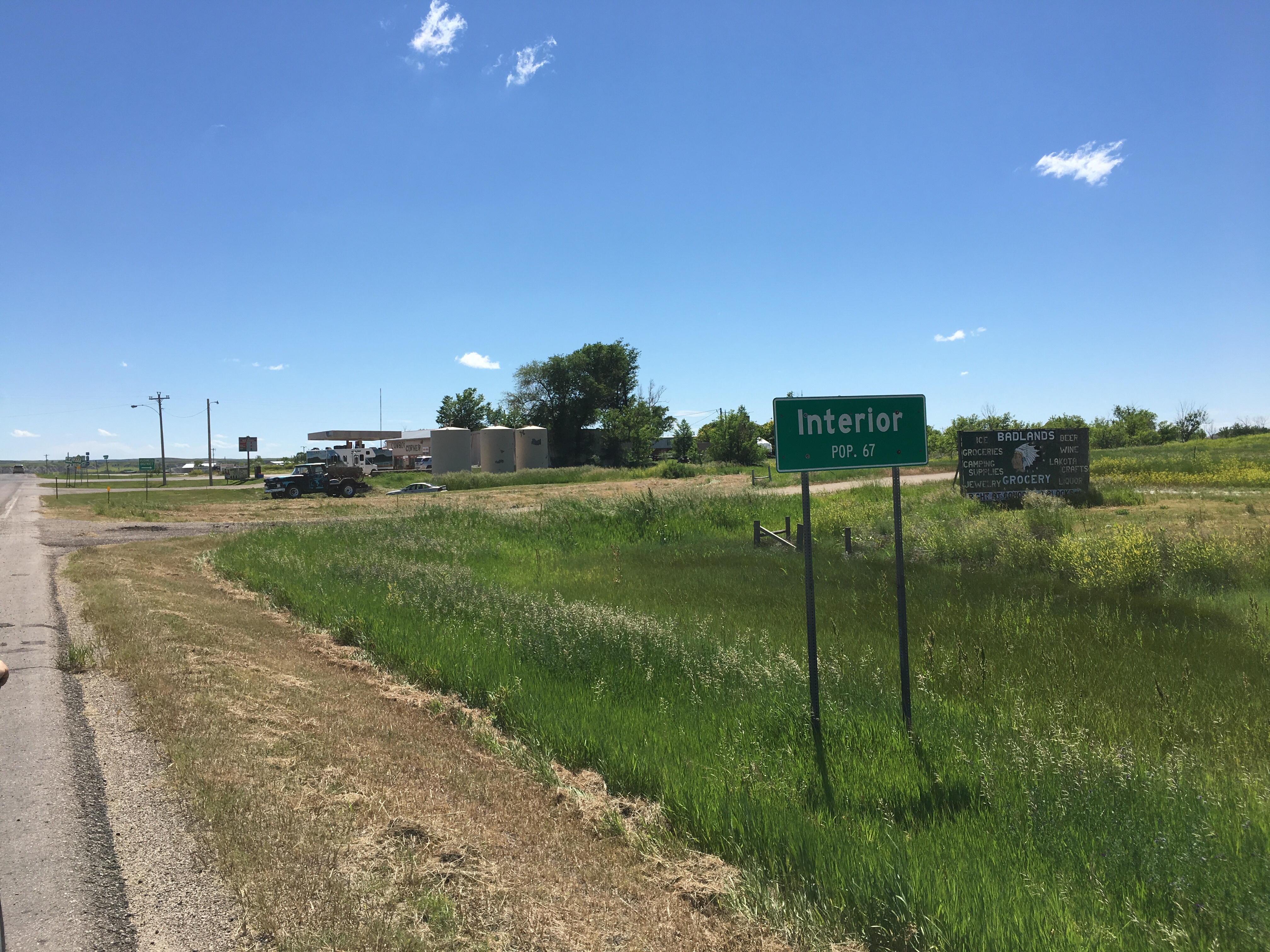
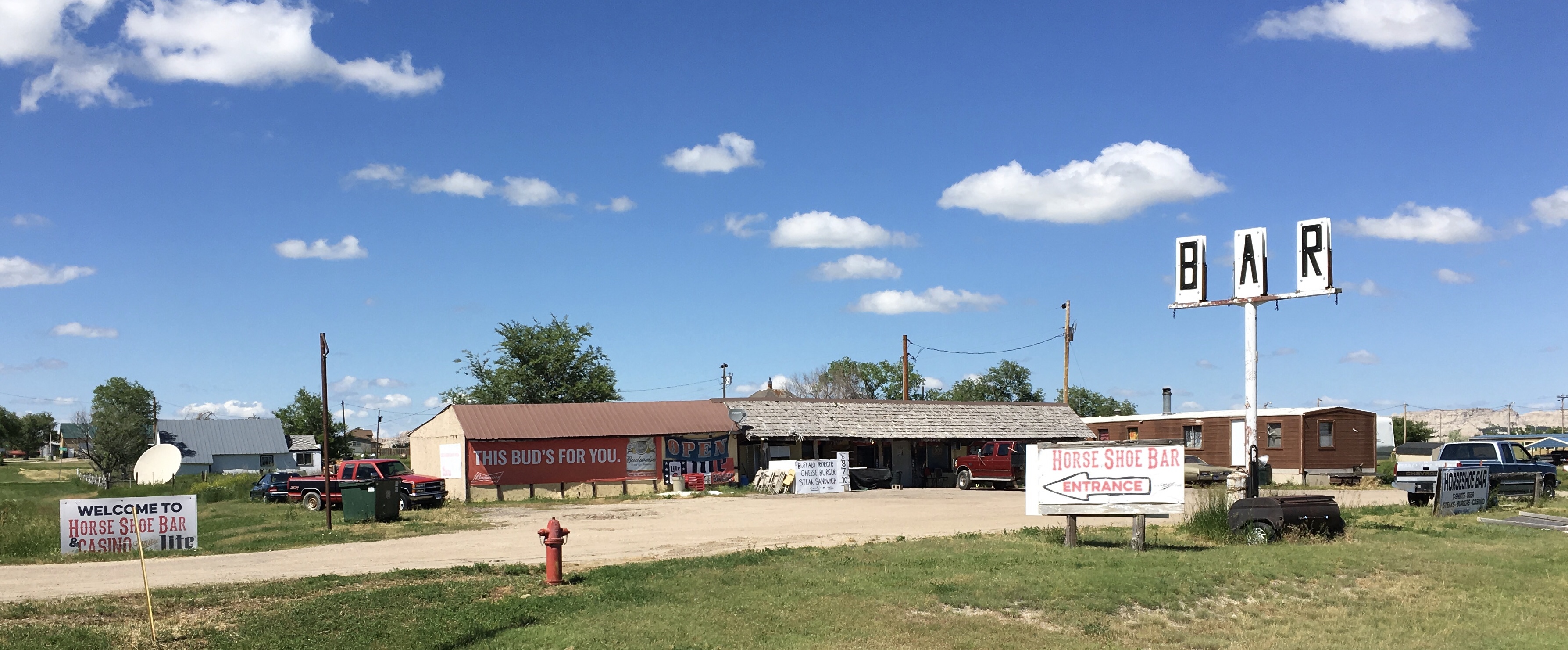
With a population of 67, we toured the business district populated with 2 RV campgrounds, a gas station, 2 markets and 4 bars. This sign greeted us on Main Street.
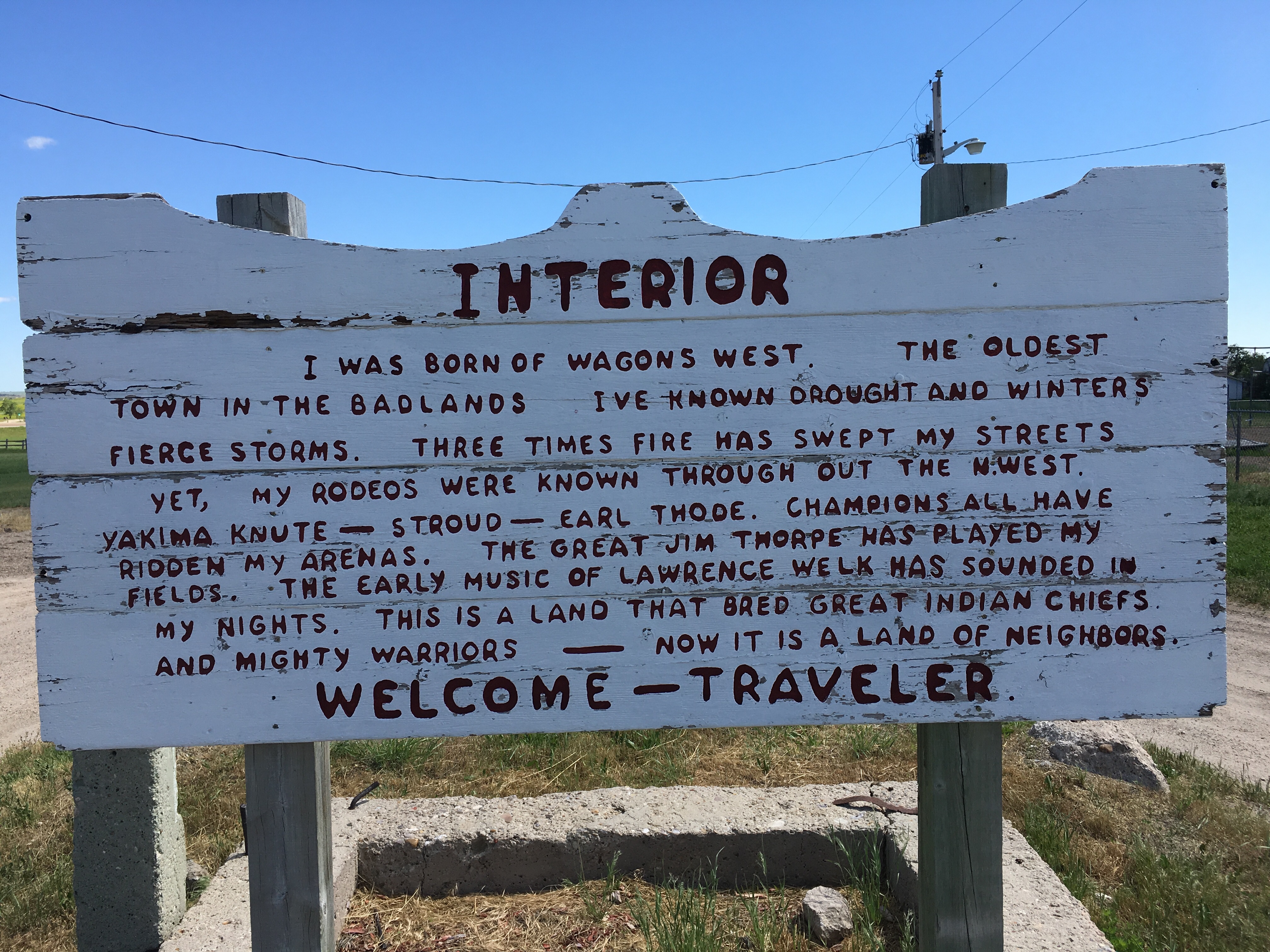
We rolled around the 1 sq mile, contemplating what everyday life is like in small town South Dakota. A small kid came running out of the Horseshoe Bar & Casino and yelled at us – “Hey – I have a bike too” – and as he ran to retrieve it, we waited to give him a “that’s cool!” thumbs up approval. In a way, we think we might have seen the real Badlands, courtesy of Interior.
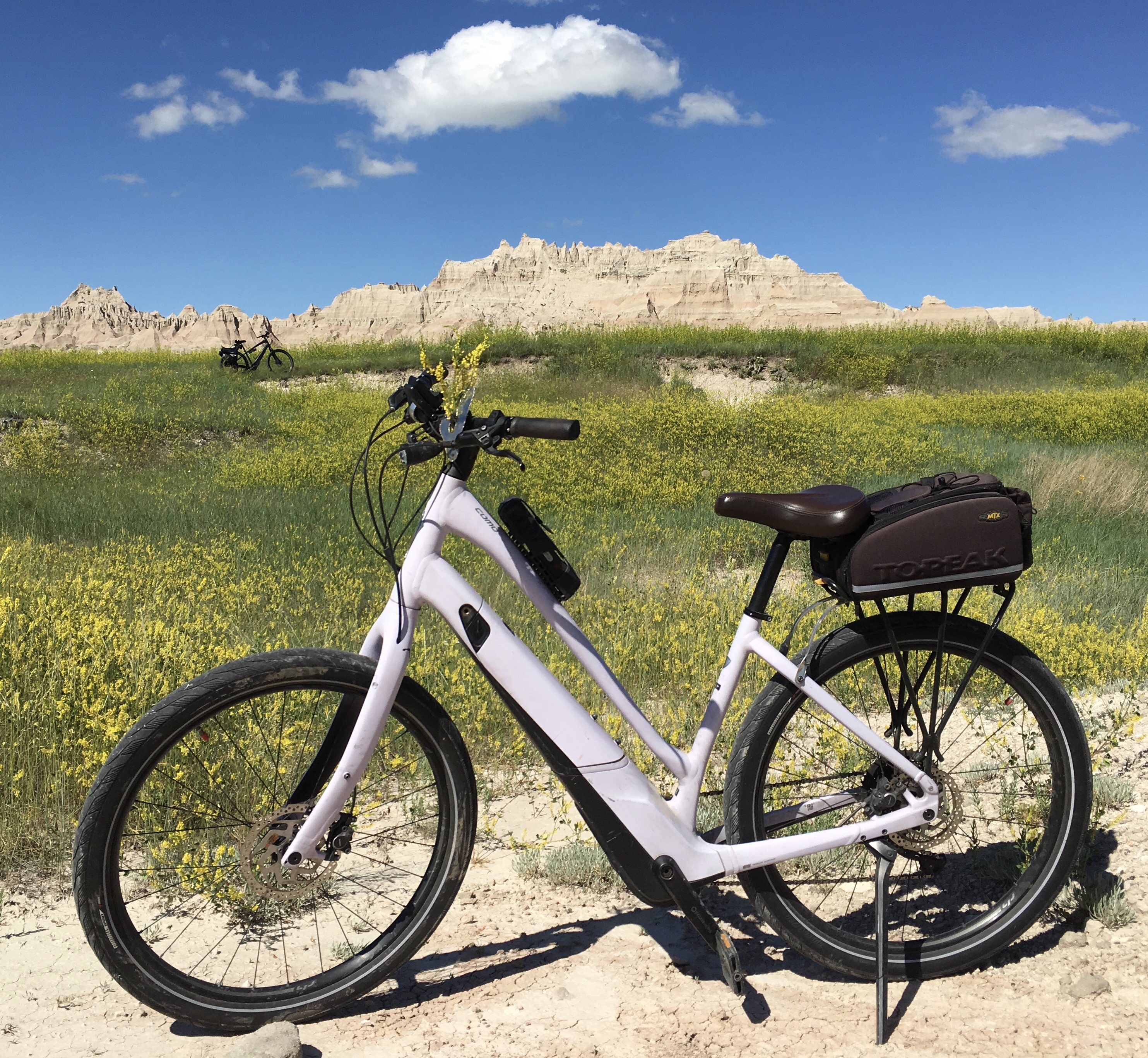
The dirt road rolled out of town and through the Crayola fields. We tried to name the colors but we need the crayon magnet to release the National Parks boxed set with prairie gold and Badlands blue. Instead we decided on a Como photo shoot.
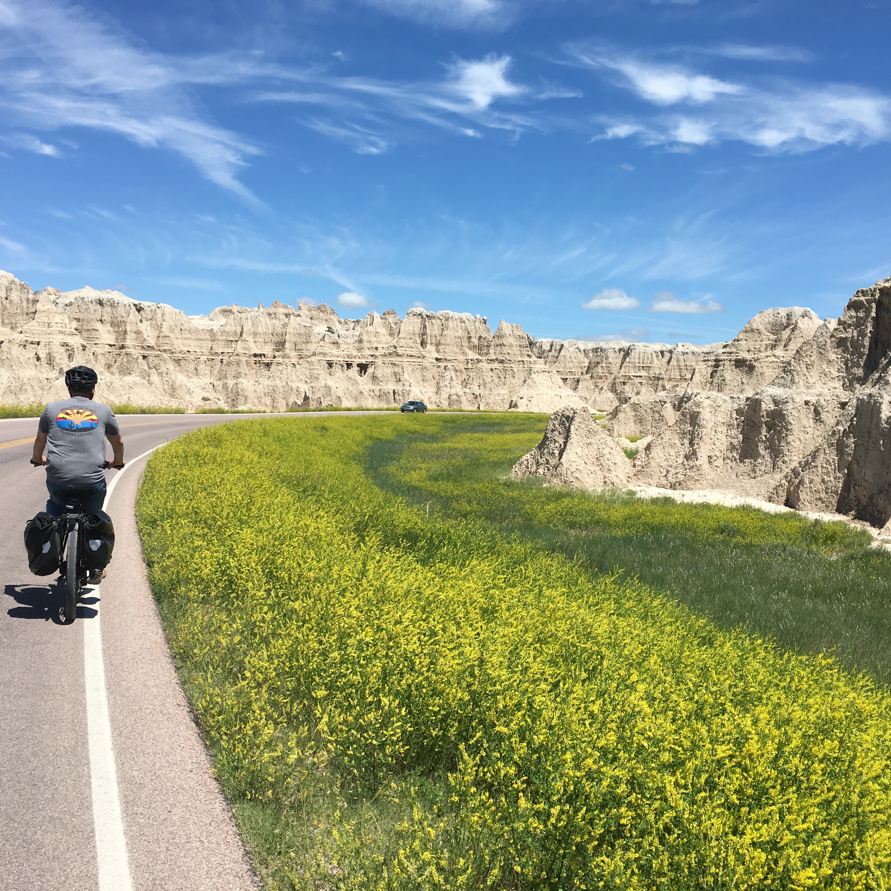
We made the return trip on the paved Badlands Scenic Byway. The full day of bike and hike allowed for a grilled steak and blue cheese mashed potato dinner under the patio canopy back at site #1. Ironically, a Tesla is camping in our old site #4. You think they stopped for a charge in Wall?


Amazing! Thanks for sharing with us all your interesting travels. Feels like we’re right there traveling with you. ❤️
Any Texas hold’em at the casino? Always looking for a good one to put on my bucket list!!!! Great pictures and blog of your trip. Keep um coming 😎👍
Uncle Tom