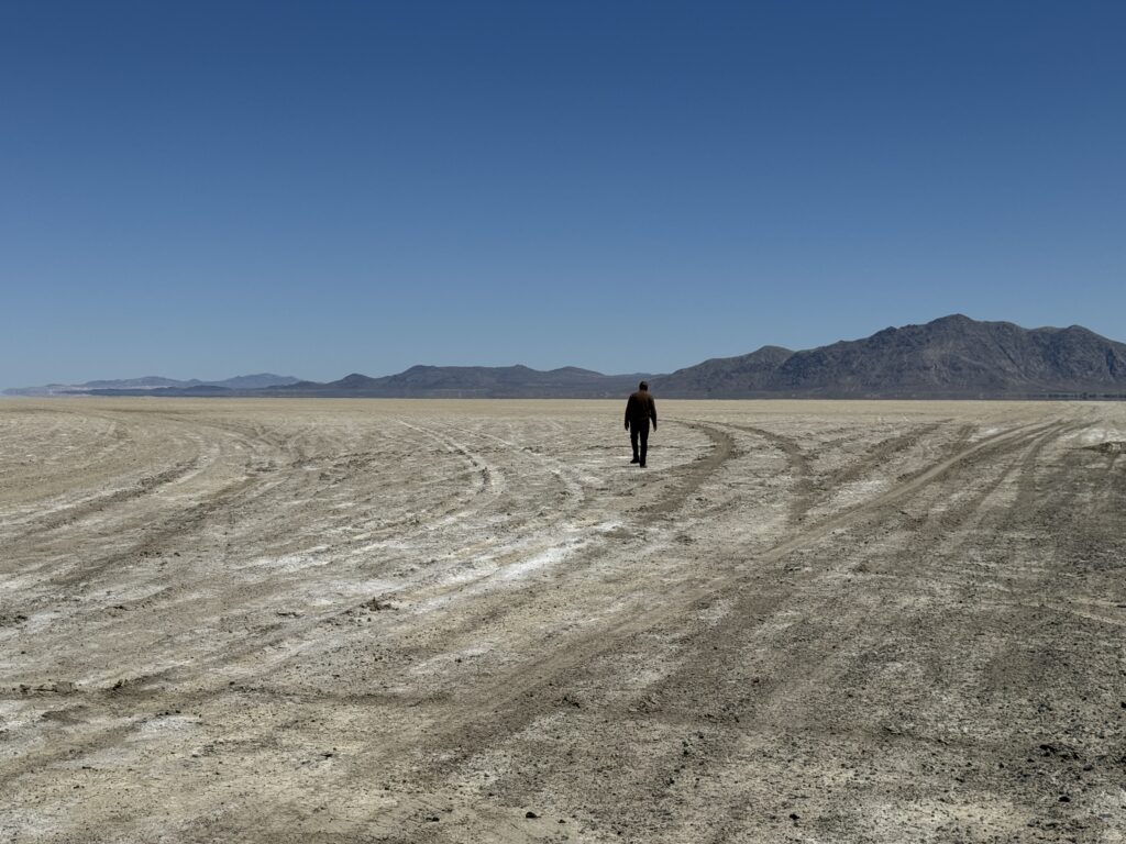
Twice as many climbers perish on the descent after summiting Mt. Everest than on the ascent. They don’t perish trying to summit, they perish because they miscalculated when to call it quits. One of the harder things to do in life is to turn around. It’s natural to keep doing what you are doing, making a little progress each day in the general direction in which you are headed. It is hard to say, I’m not going to head that way anymore. With all of California and Oregon just two or three hours away, it was hard to call Black Rock Desert’s The Playa our furthest point west. But, we did.
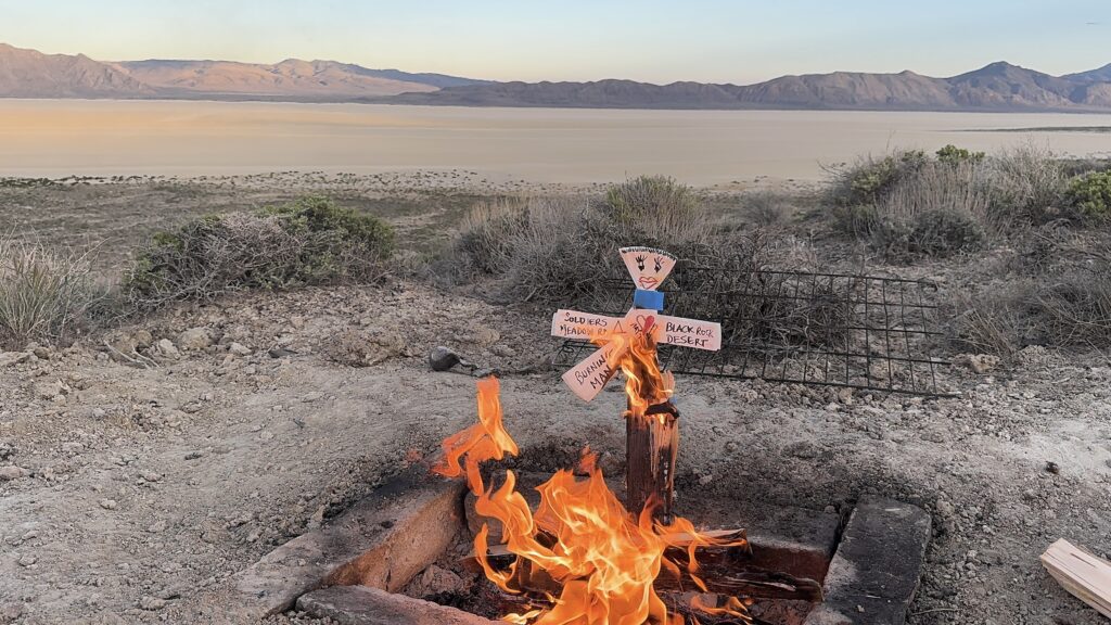
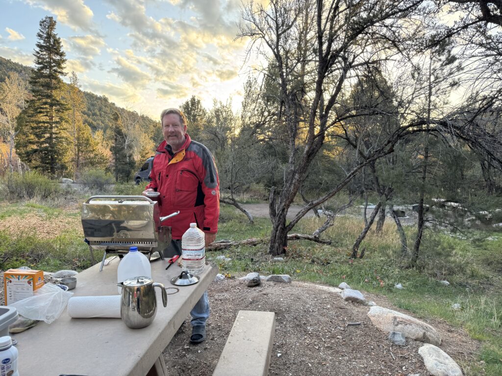
For thirty nights we have crawled on hands and knees into bed. Let’s face it, we are old(er). We have a bum knee and a sprained ankle. Our medications are running low. Yep, we have medications. Yuck. Honestly, sometimes we felt like we should have called it the first time it snowed on us while we shivered off the flu inside a thin nylon wall a month ago. Burning our paper man overlooking The Playa, this time it felt right.
It feels like the end of an era. It does not feel like we will be this way again. As we begin to make our way back east, we challenge ourselves to travel on roads that we have not previously been on. Turn on the ‘avoid highways’ filter on Google Maps. Pull out the bound 2019 Rand McNally Road Atlas and cruise the scenic bye-byways. Reflect on the five #tentlife journeys across the US and Newfoundland. Start the process of closure.
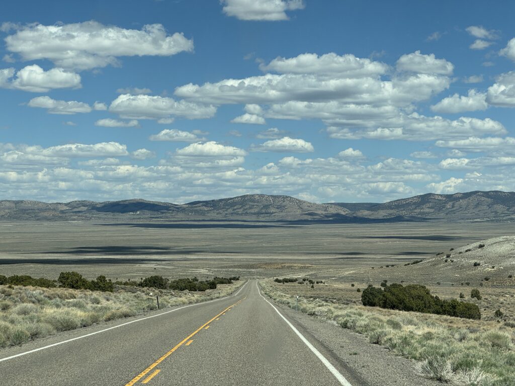
There’s a stretch of Route 50 that begins in Fernley, two hours south of The Playa and runs east across the state to Ely, just west of Baker, the home of Great Basin National Park. The 408 miles, dubbed The Loneliest Road in America, are vast expanses of nothing but a quietly dramatic reminder of our small place in this big world. Coincidentally, it is trending in the news as large stretches of this government land were slipped in to the budget bill for sale. It looks vast, lonely, and unable to sustain much but it’s probably full of lithium or cobalt or some such precious metal and someone sees the current political climate as ripe for change – and profit. For now it is mostly BLM. We could simply drive out onto it and camp if we desired, which is pretty tempting.
Three years ago on our Can’t Hold Us journey, an impromptu, check the we-visited -Great-Basin-box off the National Park list, an overnight intention became a weeks’ stay in Roxie, devouring the park and living off-grid in the Baker Creek campground. With the loneliest road ending in possibly our most favorite National Park, it seemed apropos to spend one more night amongst the ancient bristlecone pines in the clouds of Wheeler Peak. We may never pass this way again.
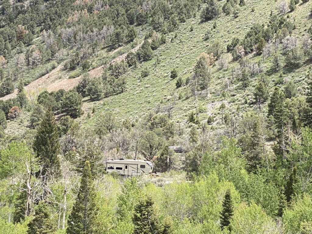
Our go-to first come first serve Baker Creek campground is still closed for the season, but the reservation Gods are smiling on us and we secure the last site under the gaze of Mt. Wheeler on the Upper Lehman loop. We are the only tenters in acampground filled with a smorgasbord of vanlife from vintage VWs to Beast Mode Storytellers and every conversion in between. We decided #vanlife didn’t work for us but the rest of America has gone all in. A stream, the only water source in the area, runs behind our tent providing perfect SONOS ambient music. Ironically, the water is owned by the farm at the bottom of the park and we are not allowed to touch it. In fact, the whole park is BYOW. Fortunately, we knew that and did.
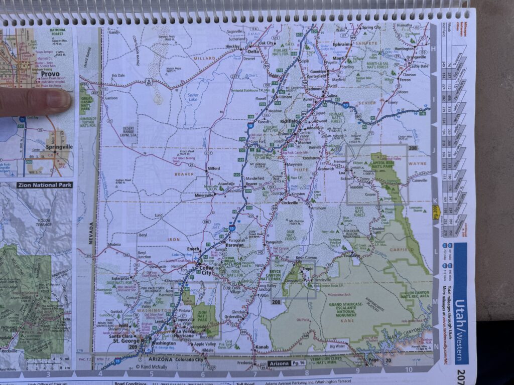
If you’re lost In an SOS part of the world, it’s fortunate to have an old school Rand McNally in the seat pocket behind you. Sitting on the border of Nevada and Utah, Rt 21 runs 100 miles through the Desert Experimental Range, a UNESCO biosphere reserve that studies the cold desert and into Milford to find some bars to check weather, get gas, and buy a piece of art at the community thrift store benefiting the intellectually challenged. South to the Cedar City Library in the Park, we uploaded photos to the blog, downloaded season 3 episodes 8, 9 and 10 of Into the Badlands, and set our sites on Navajo National Monument in Shonto, Arizona, which we picked using the dart method.
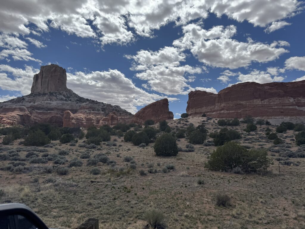
If you did not know that the Park Service has a fabulous National Monument smack dab in the middle of the Navajo Nation in Arizona, you are not alone. No one does. A rustic campground runs reservation free, cost free with views of the Monument that are spectacular. But first you have to diagonally cross Utah.
Utah 14 is a 40 mile scenic bye-byway that runs through lava fields, pine forests and Zion-like monuments then intersects Route 89 through trendy Kanab, skirting the Grand Staircase Escalante Monument and south to Page, AZ, home of Glen Canyon National Recreation Area. The few hours drive gave us time to reflect more on the Can’t Hold Us Journey, where a NYT article about the severe drought in Glen Canyon led us to go see what had been hidden underwater for seven decades. It was also the trip where went off grid in Vermillion Cliffs, closed the book on Zion with a hike up the Narrows, battled moths at Jacob Lake on the north rim of the Grand Canyon and ultimately caught the overloading bug on a found by chance festival in Flagstaff. As we moved through these scenic bye-byways and entered the Navajo Nation for our final cut across northern Arizona, we wondered what a Navajo Pueblo Night would bring.
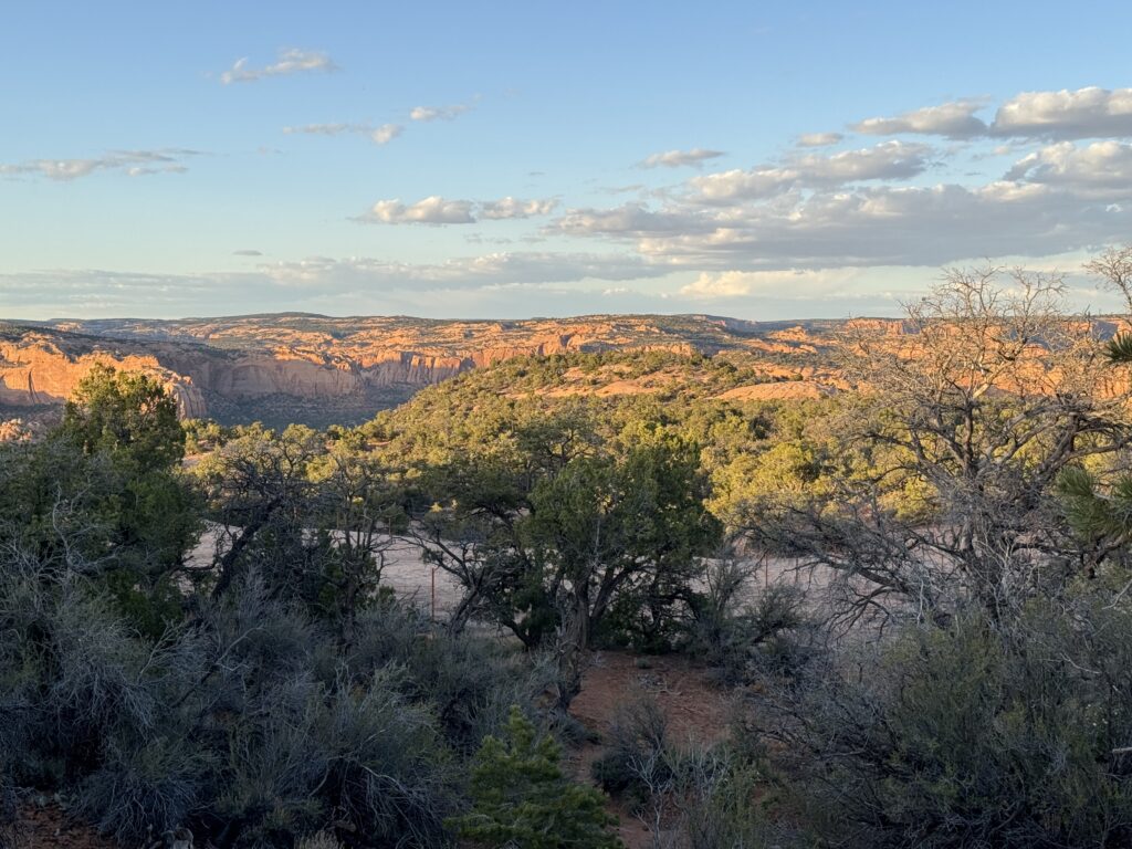
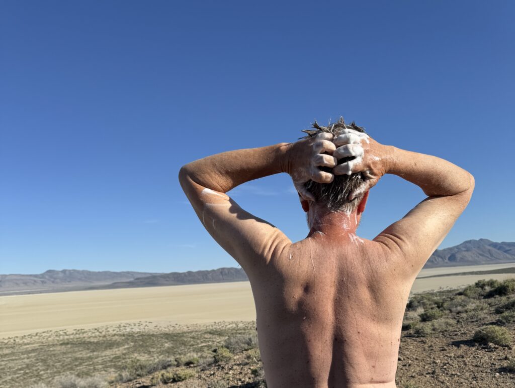
80 miles in to the center of the Navajo Nation, 12 miles off the bereft of amenities drag, we find ourselves in pure boondock mode again. Fortunately, water bottles can be filled at the small Visitor Center. With a canyon view camp site and the weather about as perfect as camping weather can get, we decide to slow down and take an extra personal day. That will mean getting creative with the meals using the mix of supplies left but it also means a shower and a chance to soak in the power of the surrounding geography. It is Saturday so perhaps campers will arrive in the afternoon but for now we have the campground to ourselves. That’s convenient when your shower is hanging from a tree branch.